
| 2020 Lidar data for Northumberland |
| All primary
Lidar data is available under the Open Government Licence
v3.0, except where otherwise stated. This processed data is copyright: Stephen Eastmead, Altogether Archaeology. Lidar images are free to download and use providing they are correctly acknowledged when published or displayed. |
|
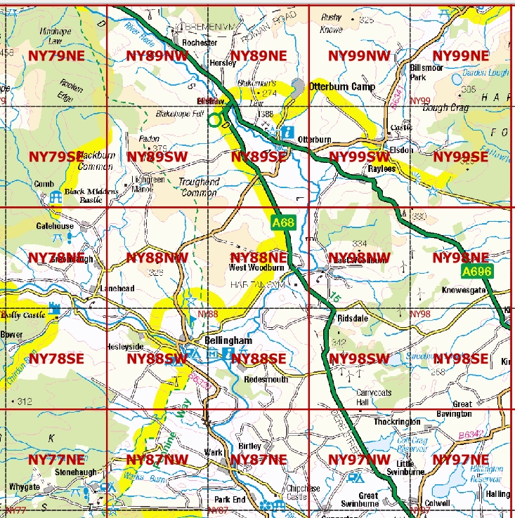
Lidar download are geo-referenced tiff images which can be imported into applications like QGIS or Google Earth. If your software cannot display tiff images this free application will https://www.irfanview.com/ The downloads contain two .tif file types, each image each will be about 75MB and 5000px x 5000px. The 2 .tif files are compressed in a .zip file which is around 100MB. Extract the files from the zip file and then zoom into, and pan around each image to view the detail. Each grid shown below is 5km x 5km i.e. one quarter of a 10km x10km grid, hence the suffix's to the coordinates. |
|||||||||||||||||||||||||
|
|||||||||||||||||||||||||
 |
|||||||||||||||||||||||||
 |
|||||||||||||||||||||||||
|
Low resolution example All downloads are high resolution .tif images 5000px by 5000px equivalent to 1 pixel / square metre. |