This project is the first excavation planned by the newly-constituted Altogether Archaeology (AA) community archaeology group. The group’s area of interest is the North Pennines Area of Outstanding Natural Beauty (AONB) and adjacent parts of Cumbria, County Durham, and Northumberland. Altogether Archaeology follows on from a similarly named project, managed by the AONB with Heritage Lottery funding. At the end of this project in Autumn 2015, the volunteer participants decided to carry on its work by forming an independent community archaeology group of the same name.
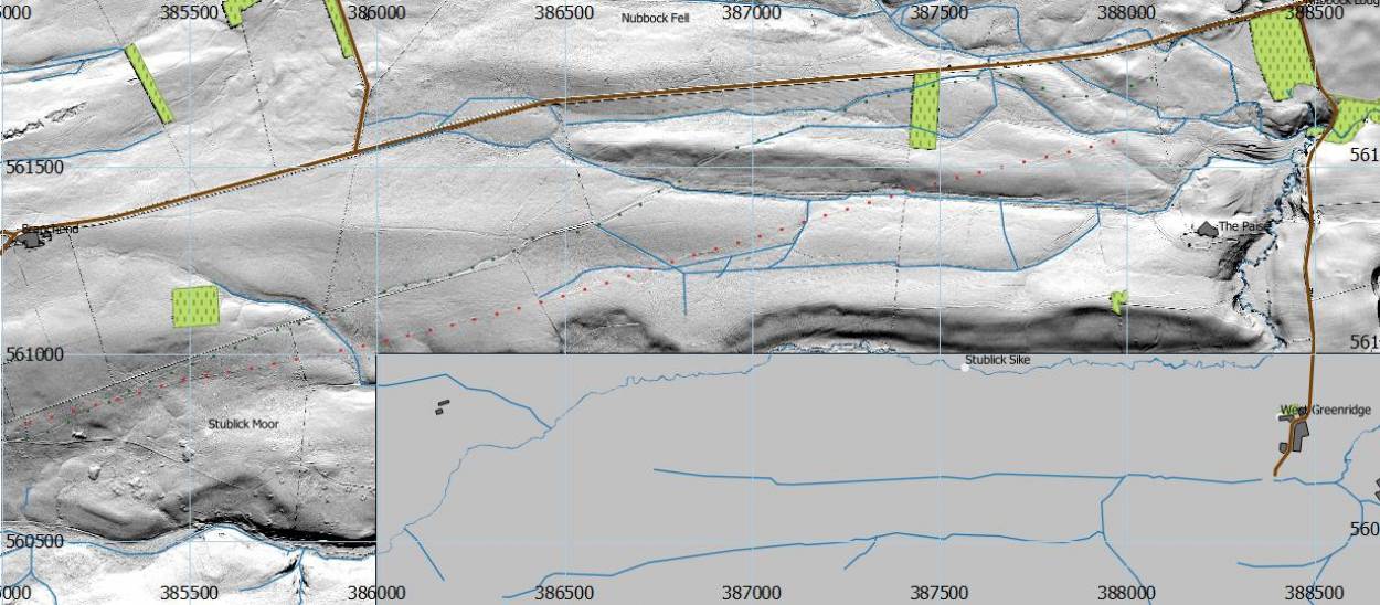
This project consisted of a series of trenches to evaluate a linear feature found on lidar passing almost due east-west for 5km, about 8km WSW of the town of Hexham (Northumberland). In addition, an historical evaluation of a roughly parallel, more sinuous holloway also present on the lidar, was made. A possible interpretation is that these two features are a Roman road (previously unrecorded) and a later transport route, both of which connect the Hexham/Corbridge area of the Tyne valley to Allendale (possibly continuing to Alston and its nearby Roman fort in the South Tyne valley).
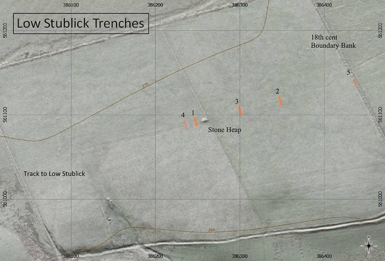
On 27th April 2016, a series of 9 test pits were excavated which provided encouraging results. Full details and the project design are available on the website Reports page. A more extensive excavation was carried out over nine days, from the 6th to 14th of August 2016. In view of the limited time available, the excavation was only of the straight linear feature as it was felt that historic studies had securely identified the holloway as a medieval route.
Five trenches were dug at Low Stublick and a further two at Watch Currock. In summary: Lidar images show two linear features south of Hexham, running in a south-west direction from Corbridge. One is a sinuous holloway, the other a straight linear feature seen for about 5km, although with a gap of 1km. Historical studies show that the holloway is a road that was in use in the eighteenth century, but superseded after that by the modern road system. The straight feature was not present on eighteenth-century maps, it is lost where it passes through an area of medieval arable cultivation, and it is not used as a later track or as a parish, estate, or field boundary.
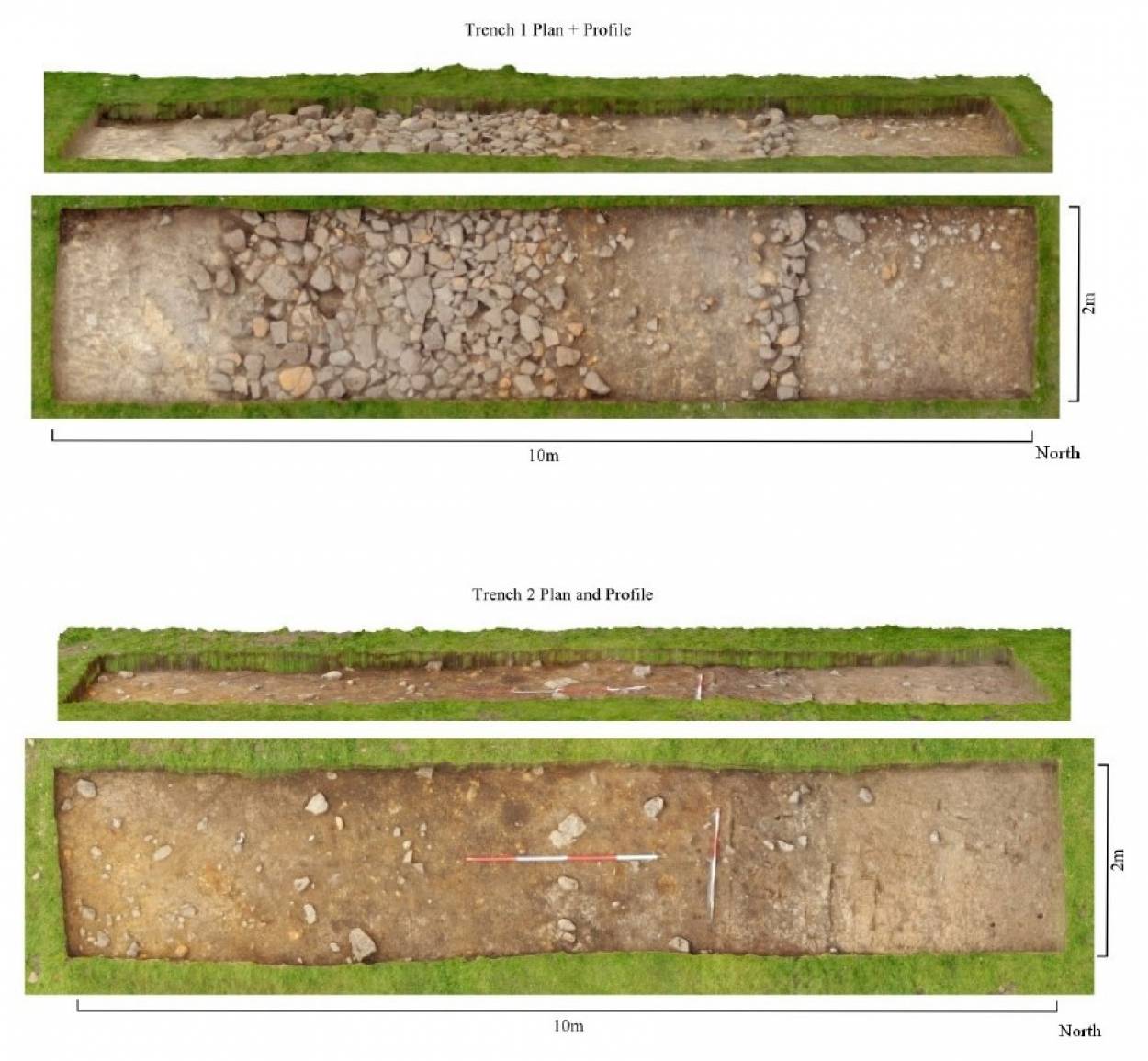
Excavation showed the linear feature to be a road with a simple structure (a single layer of irregular stones between kerbstones), consistent with Roman roads in the region. An eighteenth-century field boundary-bank passes over it. No datable finds were made, which is as expected for a minor Roman road. It may not have been completed or much-used.
There seems little doubt that it is Roman in date; archaeological and historical evidence point to a pre-medieval date, when only the Roman army had the skills, resources, and excess labour available to construct a straight, stone-built road, and then probably not make much use of it.
The full report is available on the Reports page or by clicking here
|