
| Selected Project Article |
| Back |
| The Northumberland OS Name Book Project - Allendale | ||||||||||
| Introduction | ||||||||||
| Click images to enlarge > Close image tab to return | ||||||||||
|
||||||||||
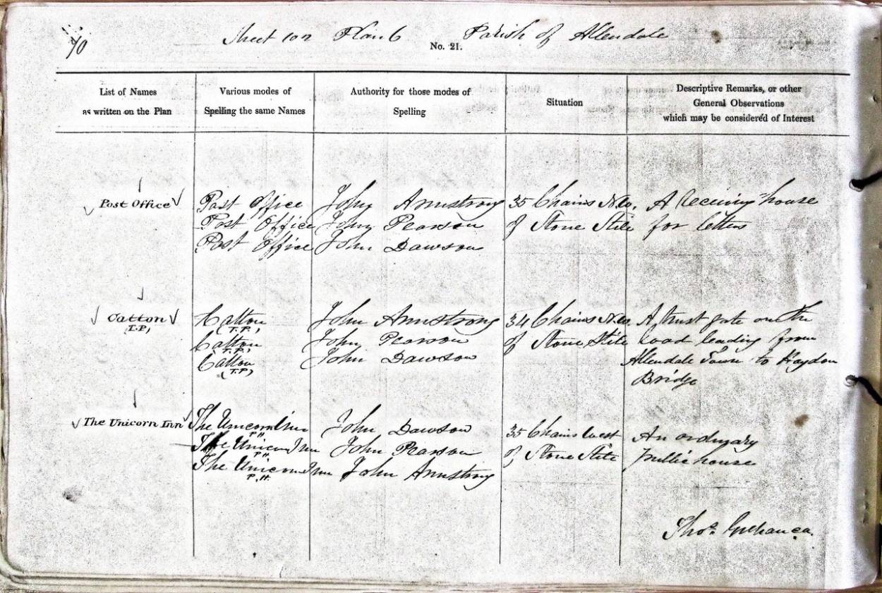
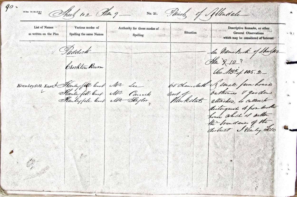
| Altogether Archaeology is taking part in a large project led by Professor Diana Whaley of Newcastle, to transcribe the OS (Ordnance Survey) Name Books for Northumberland. The Name Books were compiled by a large team of surveyors when gathering the names of various features, buildings and settlements for the First Edition of the 6 inch (6 inches to the mile) Ordnance Survey maps for England and Wales. How did the Ordnance Survey start? 1745 - the Jacobite Uprising lead to the need for military roads and installations, so the Board of Ordnance (today's Ministry of Defence) had maps drawn for the northern parts of Scotland first, lead by William Roy, whose “Great Map” took from 1747 until 1755 to complete. 1791 - this work and later mapping, driven by the real fear of a French invasion, resulted in the recognition of what became known as the Ordnance Survey. Southern England was mapped for the first time with a high degree of accuracy, to plan for defence against an invasion - the positions of roads and landscape features that could be used defensively had never before been accurately drawn. 1846 - the first country ever to be fully covered by accurate mapping, however, was Ireland, with the publication of a 6 inch map - for taxation reasons. Place names, names of features and buildings were recorded in books of names, including both English and Irish names. These maps coincided with the start of the Potato Famine which dramatically changed this newly recorded landscape. 1840s to 1878 - the surveyors returned to the British mainland and brought with them many who would then take part in the drawing up of 6 (and 25) inch maps of Scotland which finished with the Orkneys and Shetlands. c. 1860 - in drawing up their Name Books in England for the First Edition OS maps, they continued to record the local names for places, features, buildings etc. and worked hard to arrive at acceptable spellings. This meant that every name entered in the books had at least three supported representations of that name. They started with landowners and agents, then people of standing, like the clergy and school teachers, while in remote places they relied on tenants, shepherds and labourers. They also used notes from gazetteers etc. The Scottish Name Books, of which there are 1688, have been digitised since 2013 and can be accessed on the internet. In England, the HQ of the Ordnance Survey used to be in the Tower of London, until they had a serious fire in 1841, which saw them be relocated to a former barracks in Southampton. Sadly, in 1940 the “new” HQ was severely damaged by enemy bombing and all of the English County Name Books, except for Northumberland, County Durham, Cumberland, Westmorland and Hampshire were destroyed. They are now deposited in the National Archives in Kew. Diana Whaley and her husband Ian have photographed the 103 books for Northumberland, each with between 7 and 320 pages (average of about 100), divided into the parishes of the time and in 2016 gathered a group to transcribe these works in order to make them accessible to all through the internet. Those who recorded the names and descriptions were a mixture of civilian assistants, Sappers and members of the Royal Engineers - there are 42 different signatories. Altogether Archaeology has a team of 12 members who have now started the transcription of about 480 pages from the two books for Allendale. It is painstaking work, but offers a fascinating glimpse of life around 1860. |
||||||||||
|
|
||||||||||
| Project Record: 29 Last Update on: 06-02-2019 08:28:13 Internet Views: 1543 | ||||||||||
|