Well Head is one of a series of small deserted farmsteads and hamlets along the southern edge of the valley floor of upper Teesdale. They consist of the dwarf-wall foundations of rectangular long houses, with associated enclosures and fields. These settlements are thought to have been in use in the high medieval era (1066 AD to 1350 AD), but, as none of them have been excavated, it is uncertain over what period they were in use.
In 2011 a survey of the Holwick area of the floor of Teesdale was carried out by AA members under the supervision of Oxford Archaeology North. Three of the deserted settlements (and some other sites) were surveyed at level 3 (Ainsworth 2007); the survey results and the archaeology and history of the area are discussed in detail in the report of the 2011 survey (Schofield and Quartermaine 2011). The report recommended that the Well Head settlement should also be surveyed in detail, but this was not carried out during the 2011 survey.
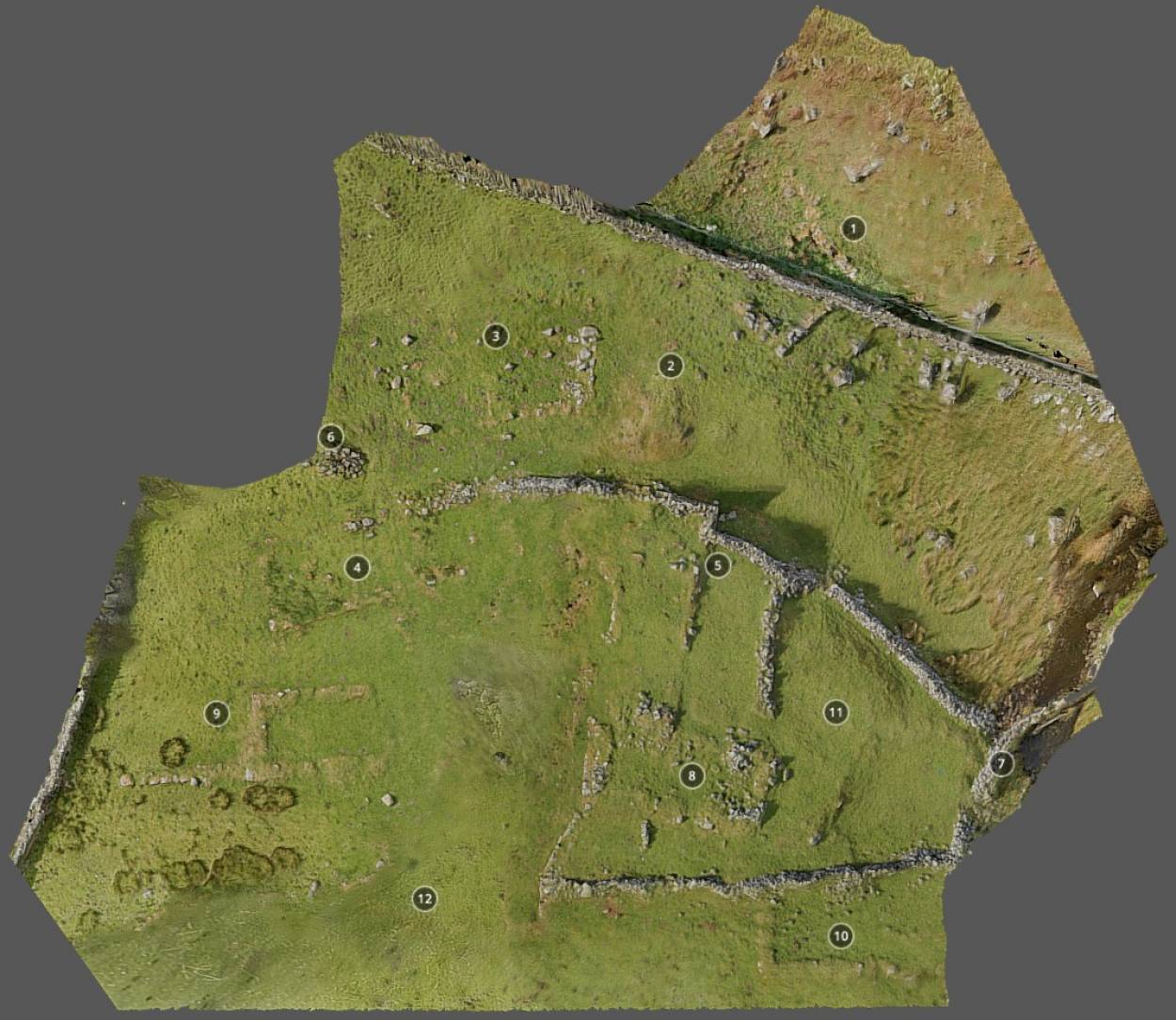
In preparation for excavation, members of AA surveyed the Well Head settlement in May 2017.
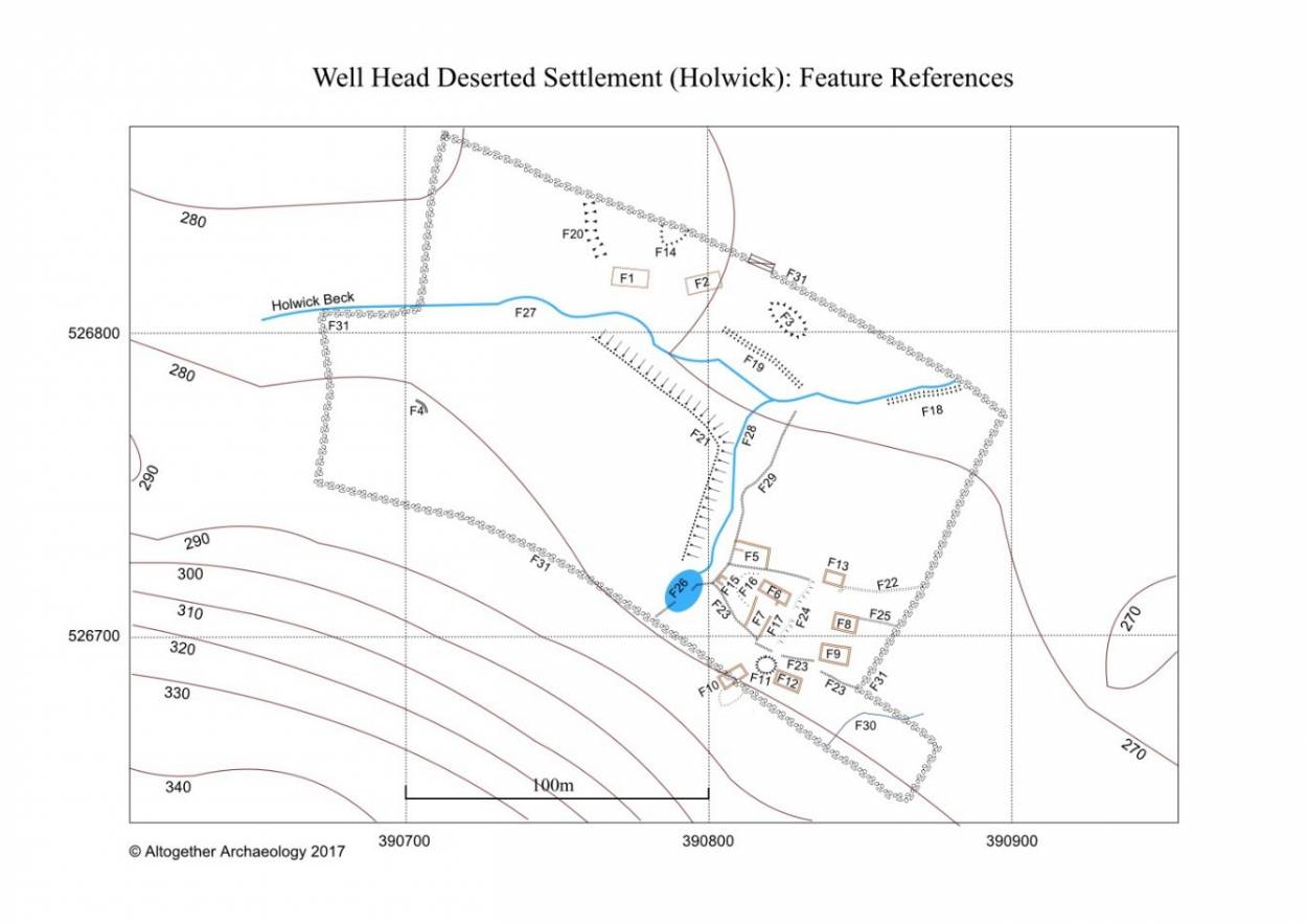
The report of the survey is available on the AA website Reports page (Green 2017). A nearby group of buildings on the side of the valley above Well Head was also surveyed (Eastmead 2017): this is probably a shieling associated with the settlement (see Reports page). The survey showed that the Well Head settlement is a complex group of rectangular buildings, ten of which could be identified, with associated yards, platforms, tracks, and field boundaries. It is one of the largest of the series of upper Teesdale abandoned “medieval” settlements and is located in a classic position for long-term settlement; on a small hillock by a spring, at the boundary of the good “in-bye” land and the rough grazing of the higher ground.
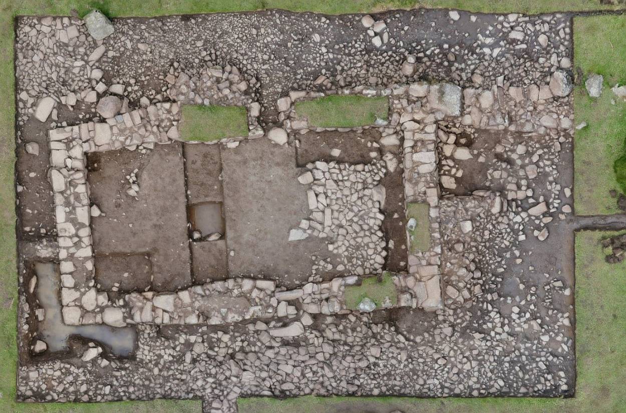
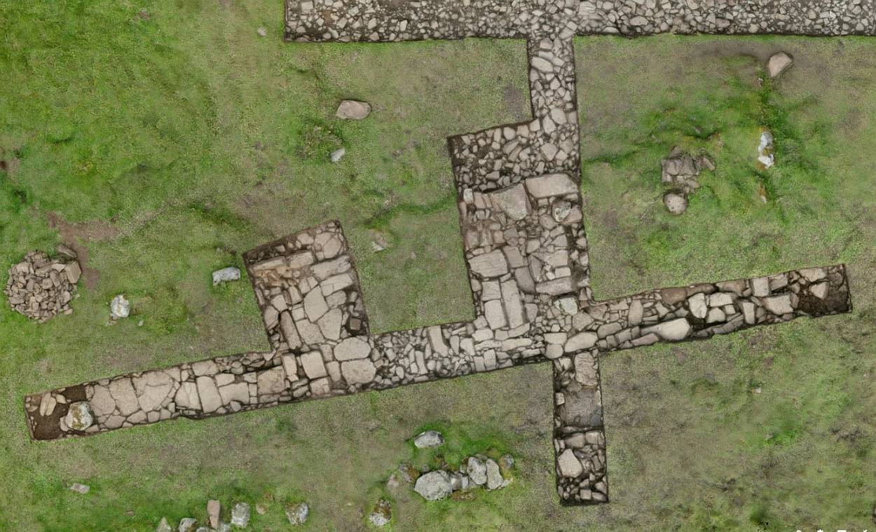
In September 2017 an excavation was completed looking at building platform F8 and extending partially over the adjacent platform F9 together with feature F15. In May 2018 Altogether Archaeology will be returning to fully excavate F9 and to investigate the scooped platform F12 and feature F4.
The interim report for the 2017 excavation and the project design for the 2018 dig is available as a combined pdf document download on the website Reports page or by clicking this link. |