Altogether Archaeology and SWAAG carried out Resistivity and Magnetometry Surveys adjacent to Old St. Mary’s Church at Brignall in October 2025
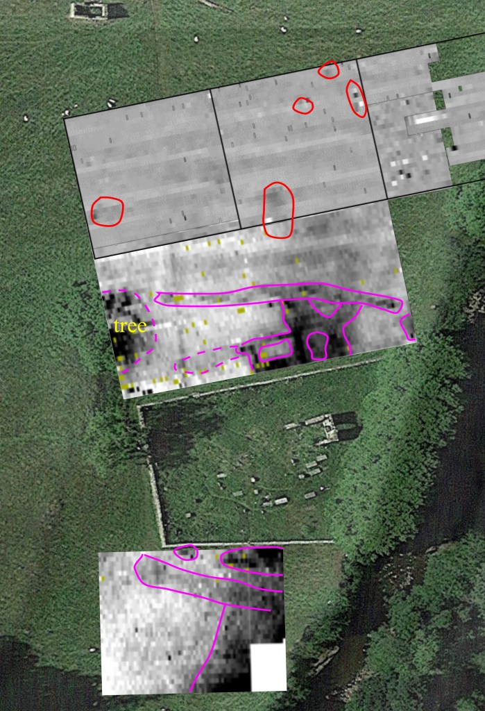
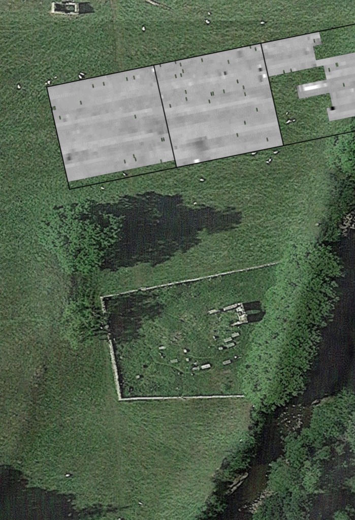
North of the churchyard, it looks possible that the building is a two-cell structure with rubble (or maybe more structures) lying to its north, extending to the boundary bank. Margaret Manchester just excavated part of the central wall of this building. The boundary bank/wall (containing the boulders) is very clear in our survey. The vertical straight line is a bank seen on lidar, probably a post-medieval boundary. The black area on the left side of the image is the dry area under the big tree. The medieval rigg-and-furrow is clear in the top right quadrant. It looks very different from the boundary bank (wide and not such high resistance.
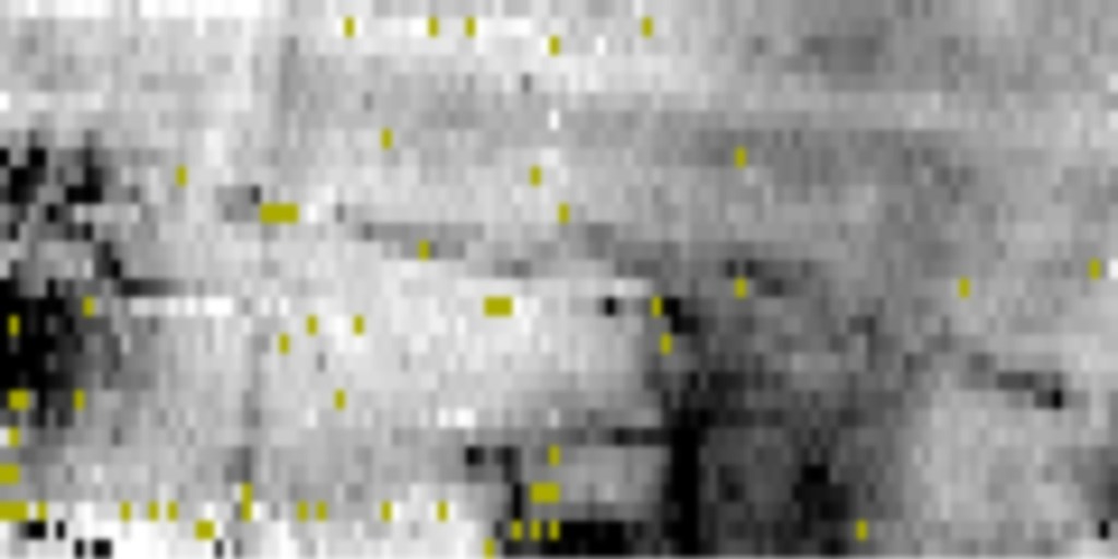
South of the churchyard there aren’t any obvious buildings. However, there is a hint of structure in the top right of the survey area.
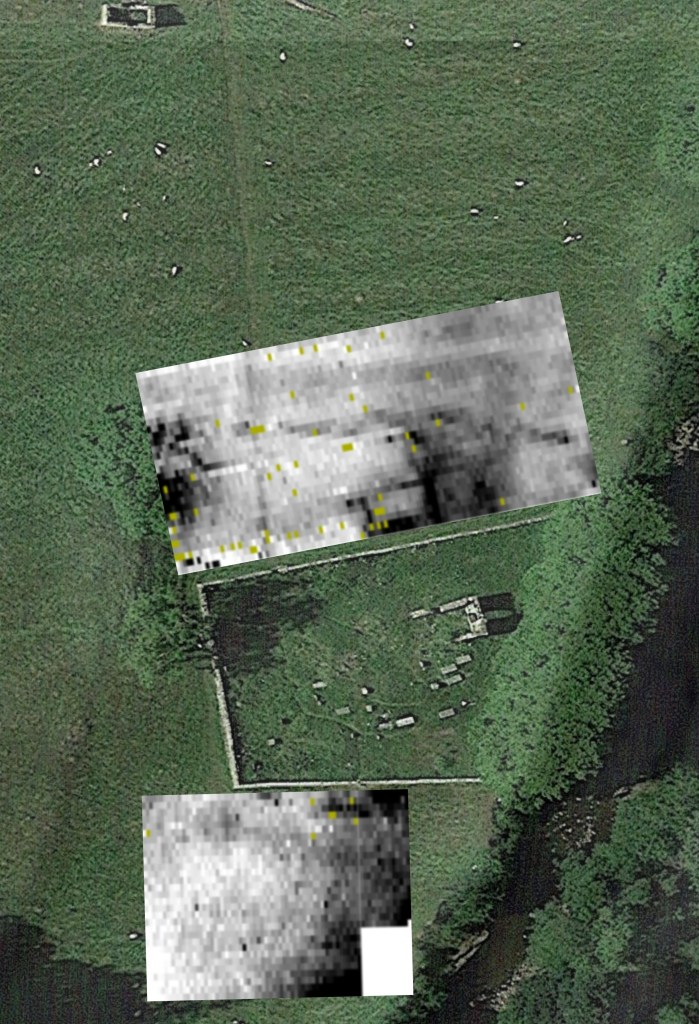
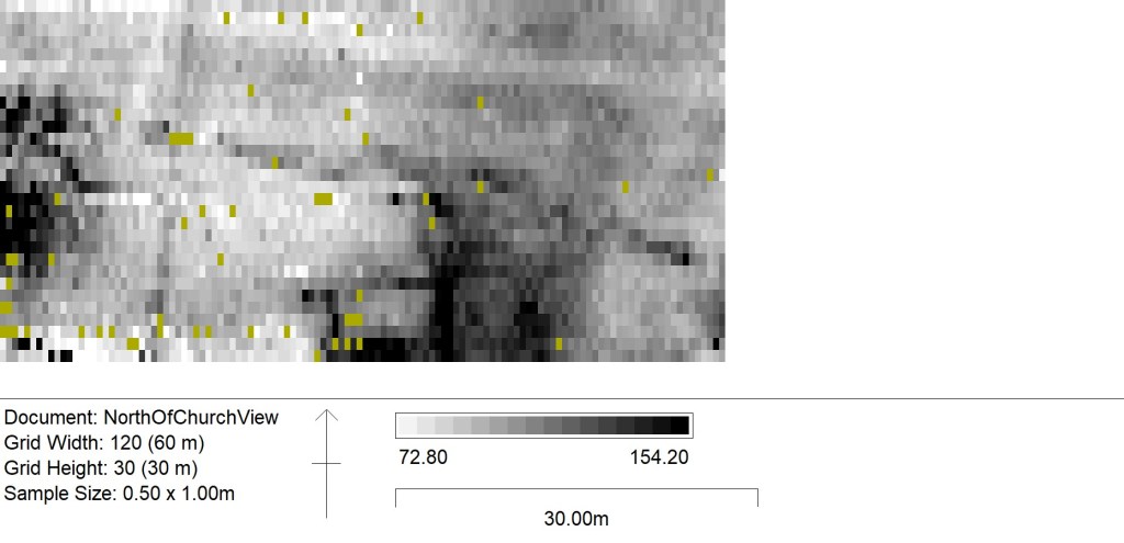
In the images below high resistance (walls etc) are shown in black and low resistance in white, as buildings show up better when shown like this. Dummy readings are in yellow.
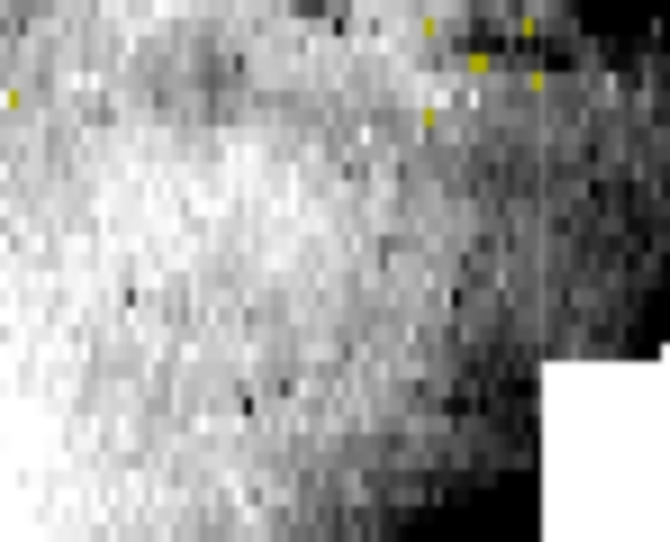
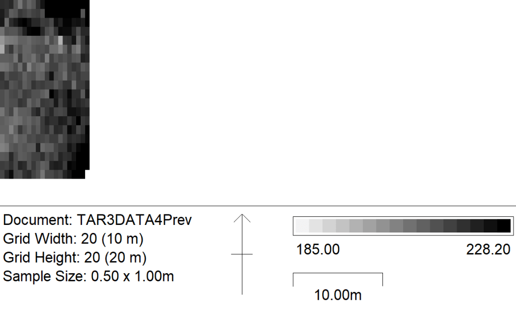
Grid 4 is the small 10 x20 grid SE of the churchyard. The westernmost 3m of it overlaps Grid 5 as was laid out as a 7m (E-W) grid but the machine refused to let us do that size and insisted we did 10m. We could have dummied the rest of the readings, but thought it quicker (and less risky) just to extend the grid to overlap.
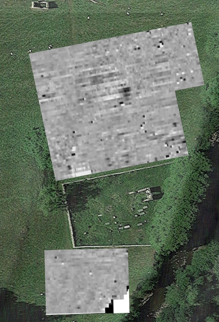
Grid 5 is the 30 x 30 grid SW of the churchyard.
Grid 6 is the 30 x 30 grid NW of the churchyard. Grid 7 is the adjoining gris NE of the churchyard.
Grids 4 and 5 used the same earth point. As did Grids 6 & 7.
You will need to click on the thumbprints below to view the full image. (The Images are in 4 separate galleries.)
GALLERY 1, Grid layout and grids from North of the Church
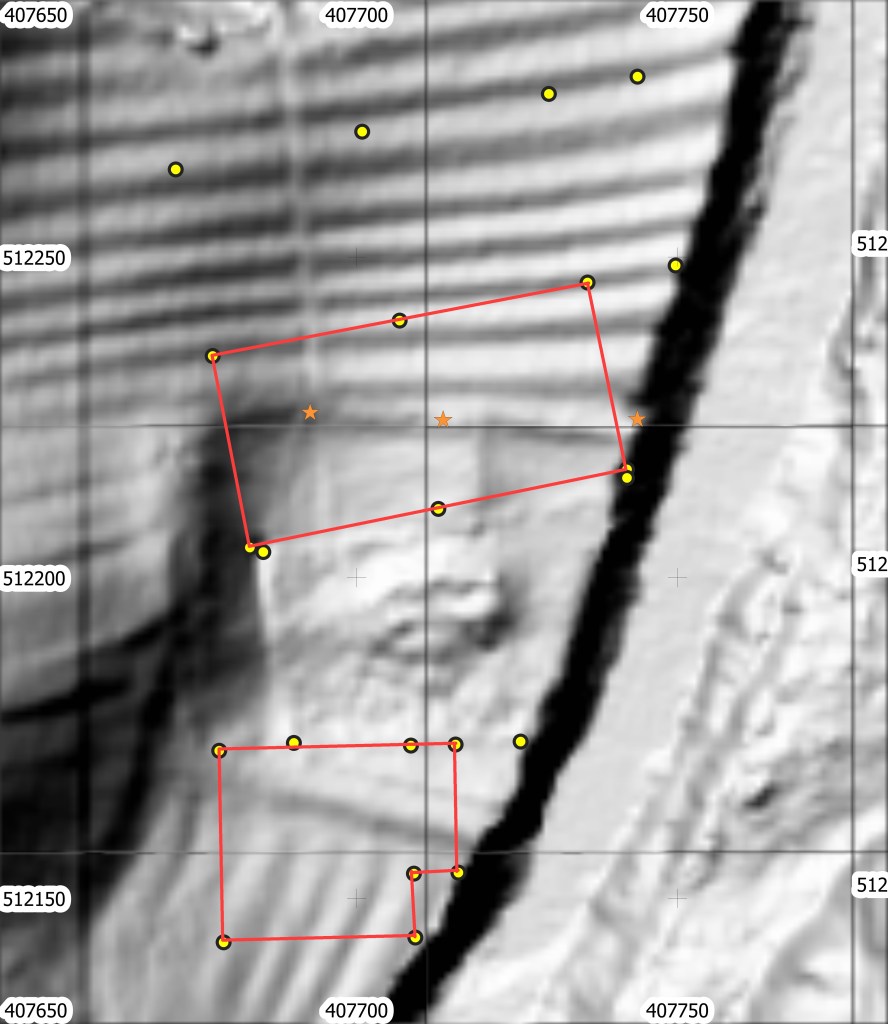
Brignall lidar with position of resistivity survey marked
Grids 6 and 7 combined, North of Churchyard
Grids 6 and 7 combined with Blur, North of Churchyard
GALLERY 2, Grids from South of the Church
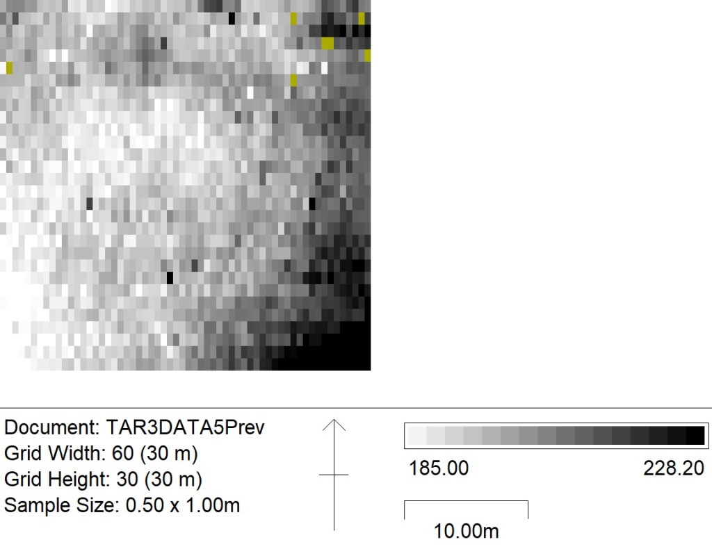
Grid 5 30×30 SW of Churchyard
Grid 5 30×30 SW of Churchyard with Blur
Grid 4, small grid SE of Churchyard
GALLERY 3, Magnetometry grids from July and October
The July grid shows the grids to the North of the churchyard only. The October grid shows both sides but the SE corner of the grid South of the church has been erased because the wire fence severly interfered with it. The grids have been superimposed on Google Earth
July Grid Magnetometry, Northernmost grids only
October Grids Magnetometry, North & South with SE corner of South grid erased
GALLERY 4, This shows the October Resistivity from both sides of the church superimposed on Google Earth and the last image is the magnetometry and the resistance combined in to 1 image and annotated.