|
Geographic Information Systems (Click on the thumbnail images to see them full size) Commercial archaeology companies spend
significant amounts of money on software and licenses; so that they
can produce professional project reports. This level of spending is
generally not available to amateur archaeologists, however some very
good results can be obtained from open source software and access to
open data map resources. The core software system being an
open source Geographic Information System or GIS. The system outlined
here is
QGIS.
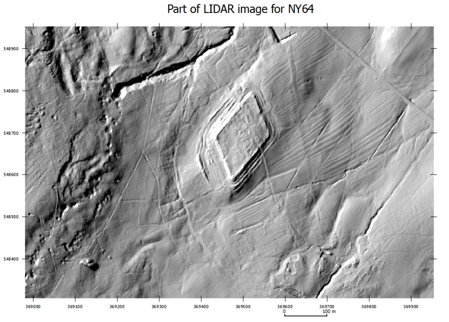
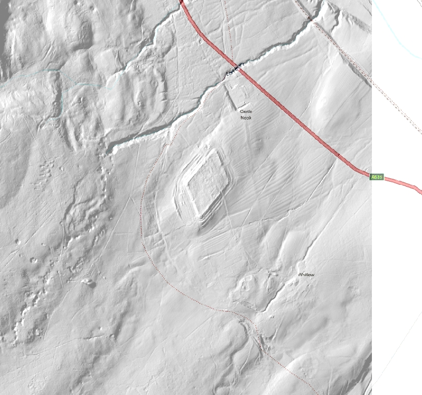
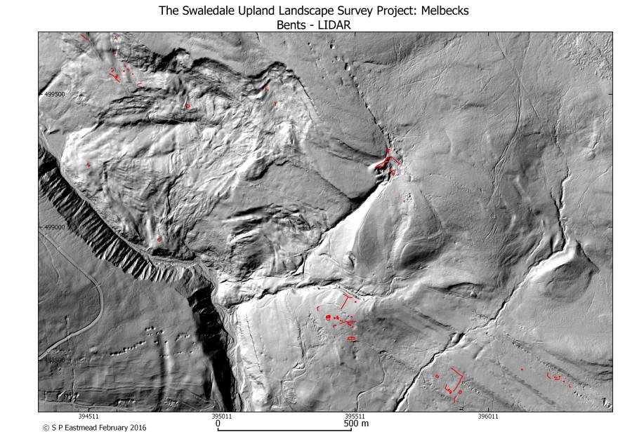
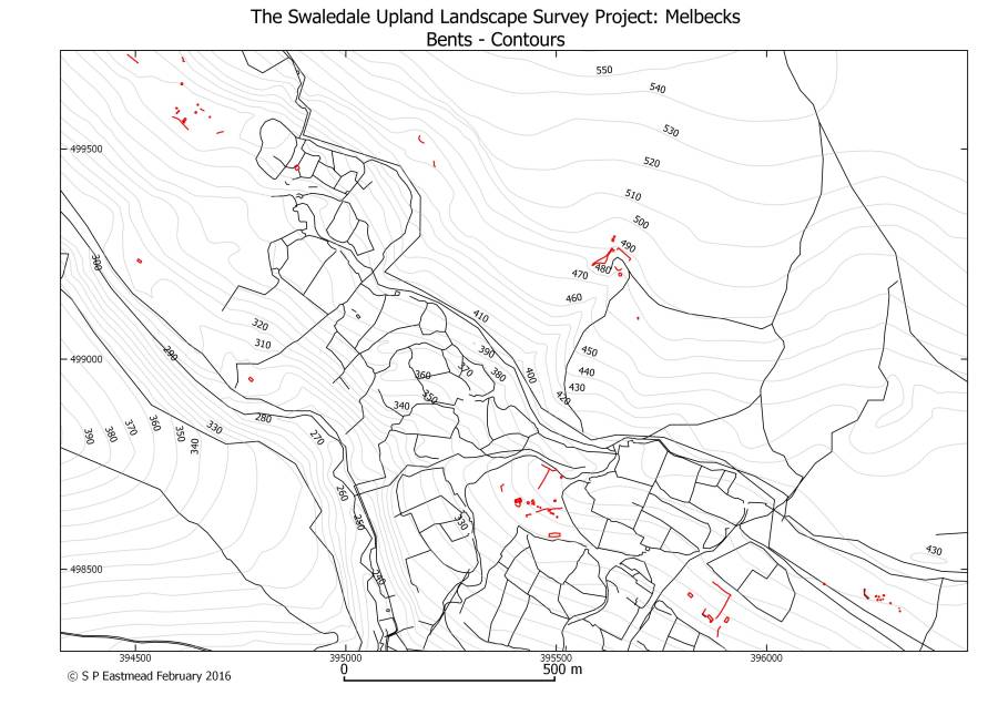
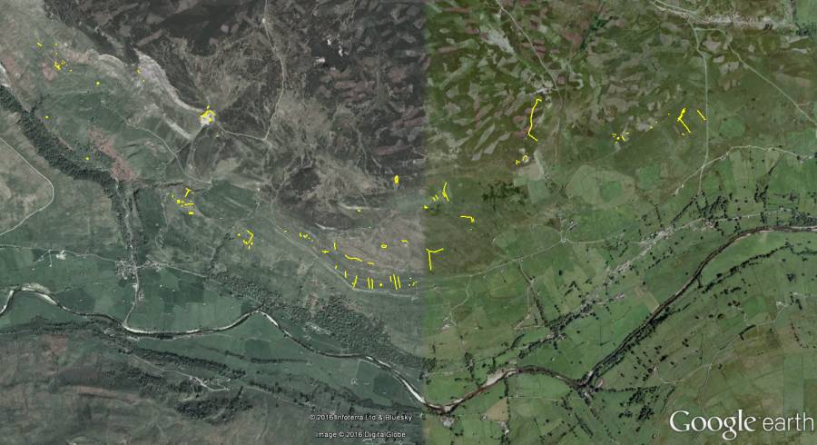
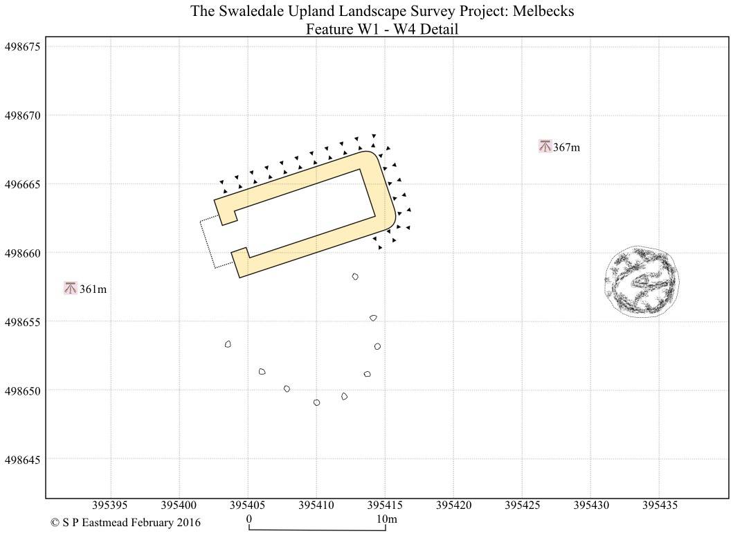
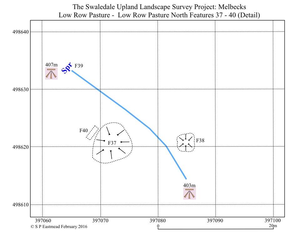
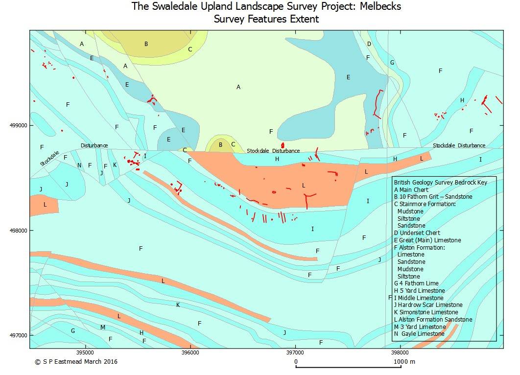
Alternatively you can superimpose a map (Image 2). If you use a suitable vector map to overlay the LIDAR image, then you can limit what is shown to specific features like: contours, paths, roads, rivers. Many archaeology projects start off with a landscape survey of archaeological features. If a GPS is used to record their position, then the LIDAR image can be used as a backdrop to the GPS data (Image 3). In a very similar process to displaying LIDAR images in QGIS; you can display either raster or vector maps. Both types of map are available as downloads from the OS Open Data pages. Some maps are also available on demand via the internet. Images 4 to 8 below are further examples. Image 4 is an example of GPS data on top of an open data map. Image 5 is an example of GPS data exported from QGIS into Google earth.
Images 6 and 7 are examples of GPS data being exported from QGIS to draw an accurate plan in a graphics program. and finally Image 8 is GPS data on top of a British Survey geology map. These examples demonstrate how useful QGIS is in mapping both small and large scale features. When you first look at QGIS software it's apparent complexity makes it appear somewhat daunting, but you only need to know a small fraction of its functionality and individual steps are quite easy to do. If you want to have a look I suggest visiting this webpage. Most questions can be answered using carefully crafted search questions on Google.
|